Rob's iPad
a special report by Rob
April 25, 2017
Although we have two MacBooks, a couple of iPhones and two other iPads on board, my iPad is used almost every minute of the day. The one I am referring to was purchased over a year ago in Beaufort SC when my original iPad would no longer allow us to plan a navigation route. More on that later.
I am up early and after coffee, out comes the fully charged and well rested iPad. e-mail is first. I will reply early, as the day of cruising gets busy and I don't always take the time later. News is next. Several sources. I stopped watching televised news many years ago because too much hype, too much drama and too polarized. Reading is calming, I can select what I wish and move along if I want to.
After the news comes the ever important weather. If I leave the boat, I don't want to get wet. But if the boat goes someplace, our safety relies on the ability to gather weather forecasts. We both look at several bookmarked sites to see what the wind and seas are doing before we go anywhere.
After my second cup of coffee, the iPad goes back to the USB charger while I eat breakfast and we prepare Linda Jean to leave for the day. Part of that preparation is to send the day's route from Garmin Blue Chart Mobile on the iPad to the two Garmin GPS chart plotters using Wi-Fi. The entire route for us to follow and/or the autopilot to follow is now available at both helms, although we pretty much always use the upper helm.
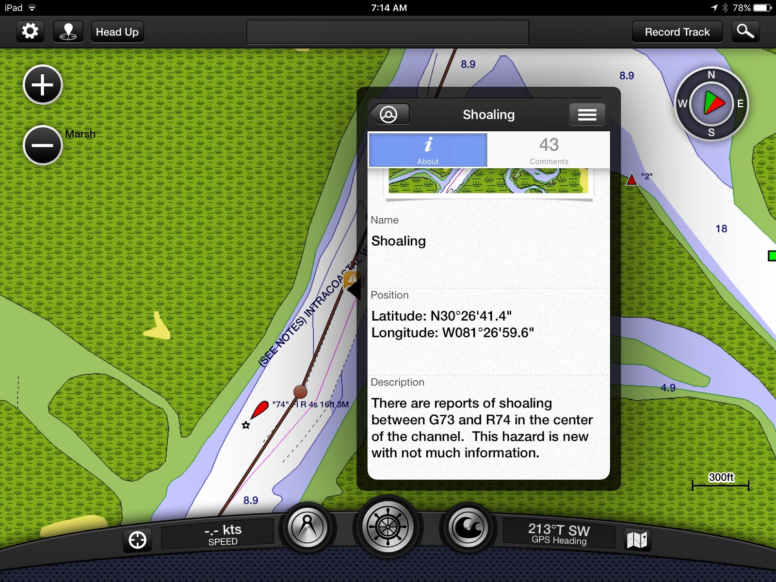
Once underway, the iPad is on the fly bridge plugged into another USB port to maintain its charge, otherwise it will eventually die being open all day. The photo below shows the route I made the previous night and open is the comment describing a caution to avoid shoaling. A shoal is basically a sand bar below the surface of the water that shifts with the currents. There are thousands of them on the ICW and they will stop a boat. Sometimes one can back off, sometimes one has to call or radio for a tow boat. They say it is not a matter of "if, but when you will go aground". These cautions provided by Active Captain, to which we contribute, are invaluable.
The screen on the chart plotter is very similar, except it does not contain all the Active Captain information. The chart plotter does show the route, depth, radar (if we are using it) and other stuff.
Aside from the cautions I mentioned above the photo, the iPad with the Garmin app and Active Captain serves the following purposes while we are underway. 1) A backup chart plotter (without depth reading), 2) anchorages with descriptions and reviews, 3) marinas with services, prices and reviews, 4) names of all bridges with height so we can determine if we have to request an opening or not. There is more, but that is enough detail.
Once we are done traveling for the day and have anchored, picked up a mooring or tied up at a marina the iPad hopefully ends up back on a charger while we go for a walk. Sometimes, no walk. Before the day ends, a new route has to be planned for tomorrow. For simplicity, the screen shot below is pretty much the same place as the first screen shot, just taken a day earlier when I was making the route. After reading the caution, I edited it a bit to the west to find more water.

If there is still time before supper, I might read the news, but more than likely I do that at bed time.
If we have Wi-Fi available, we will stream something from Netflix. If not, we have a few downloaded movies from Netflix that we can watch without Wi-Fi. Sometimes we watch on the iPad, sometimes we send them to the TV using Chromecast.
The iPad goes back on the USB charger in the main cabin for the night, to repeat this process the following day.
Next installment will be on cruising.
Written by Rob True
No comments:
Post a Comment